What are web services, how do they work, and why are they essential in modern GIS and web applications?
If you work with geodata, you will inevitably encounter web services such as WMS, WFS and WMTS. These services allow you to load up-to-date geographic data directly into tools such as QGIS, GeoServer or web applications without storing the data locally.
Web services are widely used as the backbone for map visualizations and spatial data analysis. You can explore an example web map where users can visualize and query layers using a WMS URL. Each layer added to the map includes two controls: one to toggle the layer on or off, and another to query the layer and retrieve feature information.
A GIS web service is an online data source that delivers geographic information without requiring you to download the dataset. The service always provides the most recent data, eliminating the need for local copies.
Web services are ideal for web maps and dynamic GIS applications. Most Flemish open geodata — including GRB, aerial imagery, waterways, sewer data and administrative boundaries — is distributed through these services.
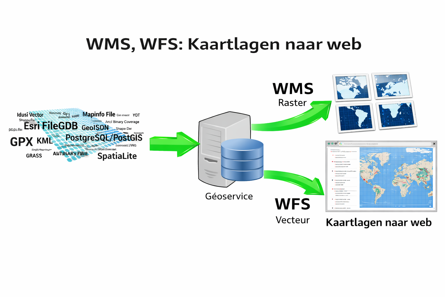
1. WMS — Web Map Service
A WMS delivers map data as a rendered image. It loads quickly but does not expose individual features or geometries.
WMS is typically used for reference layers such as aerial imagery, topographic maps or base datasets like GRB. It is ideal when you simply want to view and visualize data.
Key WMS operations:
- GetCapabilities – returns a list of layers and metadata
- GetMap – generates the map image
- GetLegendGraphic – retrieves the legend
https://service.vlaanderen.be/<service>/wms?2. WFS — Web Feature Service
A WFS returns data as individual vector features instead of images. This means you receive geometries and attributes that can be queried, analyzed and exported.
WFS is useful when you need to run spatial queries, perform analysis or work directly with geometries in a web application or GIS environment.
3. WMTS — Web Map Tile Service
WMTS serves pre-rendered map tiles. Because the images are already generated and cached, WMTS is typically faster than WMS for large datasets such as aerial imagery.
1. Flanders Data Catalogue
The central catalogue for Flemish geodata and datasets.
2. Mercator Vlaanderen
Spatial datasets managed by the Department of Environment.
3. Statbel
Belgian national statistics covering a wide range of thematic datasets.
4. OpenStreetMap & international sources
Want to integrate web services into your GEO dashboard?
I can help you select the right data sources, design a solid data structure and implement everything in your GIS or web application.